 |
Landing at Shelter Cove ~ 0Q5 |
 |

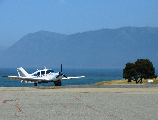
On the ramp in Shelter Cove California
|
Best time of the year to go? |
All year |
|
Flight time in a Super Viking from KAJO? |
3.3 hours |
|
Food on the airport? |
Yes. Town and the airport
are the same. The only place which seems to keep regular
hours is the deli on the approach end of runway 30. The
other places have good food but their hours are spotty. |
|
Fuel on airport? |
No, no services at all. |
|
Comments about arriving and departing |
Pretty standard, right traffic for runway 12.
Watch for deer, golfers and golf carts on the runway. |
Rate this trip
10 being best, 5 being average. |
9.0 Great location, the whole town is walk able. Good
restaurants, nice lodging. Walk along the coast. Little else
to do. |
 |
Flying into Shelter
Cove ! |
 |
Shelter Cove is located along California's "lost
coast" named that because it so far off the beaten path. Both
Hwy 1 and 101 turn inland south of Shelter Cove and don't find there
way back to water until well north. Driving to this area must be a
real pain but, I've never done it. What a gorgeous place to visit.
Pretty much all hotel rooms are along the surf line. Good places to
eat. Transpiration is
not needed just bring some walking shoes.
There used to be an golf course in the middle of
town then some developer built a runway on it, leaving the golf course
which now surrounds the runway 360 degrees. I met the airport
manager, he is also the greens keeper. While on final you have to
watch for golfers about to tee off because they drive balls right
across final just before the pavement starts. Golf carts are another
worry but they are a lot easier to see.
There are NO services on this airport at all! You're doing good if
you can park where there are tie down ropes. The ramp is pretty
rocky so go easy on the prop. The runway and taxiways are
acceptable. This place does go IFR often and there is no instrument
approach, have other plans.
Seems like most the restaurants in town fail to keep regular
business hours and that's a little annoying. The store/deli near the
RV park seems to be the only reliable place in town (Approach end
runway 30). Try the Chart Room if there are open (Approach end
runway 12). I got lucky once and it was very good.
Other things to do:
-
Camping
at the airport.
-
Famous 'black sand beach' approx 1.4 miles off airport, the
beginning of the 'lost coast, south' trail.
-
There is excellent 'tea house' just on the south end of airport.
-
There is boat ramp next to the airport; some people bring
surfboards inside the plane and then surf.
 |
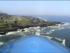
I was coming down the coast from
Crescent City on this visit. |
 |
Shelter Cove Airport from the South |
 |
Turning downwind for runway 12 |
 |
Runway 12 approach end |
 |
To say the airport is built next to a
golf course would be an understatement. The airport is
surrounded by an golf course and to walk from the airport to
town you'll need to cross a fairway. |
 |
Cessna N739EQ on final to runway 12 |
 |
Piper Arrow N32481 departing runway 12. |
 |
Out in the middle of no where we came across this temple. It was huge with a moat full of water. http://www.odiyan.org/home.html |
 |
Close up of temple. Look at
the trees, walkways, entrances to get an idea how huge this
thing is.
www.cnn.com/US/9605/13/buddhists |
 |
California coast line |
 |
California coast line |
 |
Watch out for golf balls on
final. |
 |
That sign says it all. On
both ends of the runway golfers tee off across final
approach |
 |
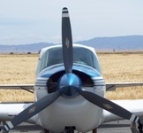
Super Viking on the go |
 |
Bonanza on the ramp.
|
 |
In the old days when a barn
stormer left his plane in a pasture the cattle were known to
eat the fabric, I guess there was something in it they
liked. Had me a little worried all night. |
 |
Got a pretty good ground
speed all the way home, this isn't a turbo. Just over 500
miles in 2:29 that includes a climb to 15,500. |
|

|
|


